[an error occurred while processing this directive]
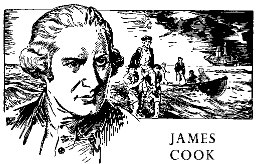
James Cook
Voyage of the Endeavor
1768-1771
New Zealand to Batavia
The issue of new Zealand was significant to geographers as they plotted the distant
ocean. Tasman had barely touched the land and left it by surmising it could be an
extension of the polar land Le Maire identified as he (Le Maire) transited the southern
end of South America. Le Maire called this Staaten Land, and Tasman conjectured with the
same name. Cook intended to determine the relationship of Tasman's Staaten Land with the
Staaten Land of Le Maire.
A young ship's boy (possibly aged about 12) was the first to sight this land, and two
days later Cook was at anchor in a bay he eventually called Poverty Bay, as he was unable
to find supplies he wished for the ship's company. The prominent headland at the southern
end of the bay was named for the first to spy the land, Young Nick's Head. In this bay
Cook had his first encounter with the aboriginal New Zealanders, the Maori. The Tahitian
priest Tupaia was able to converse with the Maori natives, but he determined they were not
friendly and Cook's men must be constantly on guard for their safety and for their
effects. In a first meeting, the sword of one of Cook's officers was taken and the result
was the shooting (and killing) of the Maori thief.
Cook set sail to the south to survey, but after less than a week, he turned to retrace
his coastal journey back toward Poverty Bay, naming the place Cape Turnagain. It was
evident to Cook that the land continued to the south and as the winter weather was not yet
abated, he decided to go north before exploring south. This would give the southern
weather a chance to become more agreeably, as the season turned to summer. In this
down-and-back maneuver, Cook twice passed through and charted the great, sweeping Hawke
Bay, named for the first Lord of the Admiralty at the time, Sir Edward Hawke. On the
southward leg of this sweep, at the southern end of Hawke Bay, natives tried to kidnap the
boy servant of Tupaia. With the boy in their canoe a group of kidnappers began paddling
off. Cook's men fired upon the group, killing two or three and allowing the boy to jump
over and swim back toward Endeavor. The incident caused Cook to name the southern
point at Hawke Bay, Cape Kidnappers.
Following the coastline northward and then west, Cook was nearing the lowest latitude
for the North Island, when squally weather blew Endeavor out of sight of land. In
beating back into the coastline, Cook determined the swell he faced indicated a large
expanse of ocean and that he would begin moving south along the west coast. More bad
weather again blew Endeavor off the coast, but Cook was able to identify the
islands Tasman had called the Three Kings and also to fix very accurately, the Cape Tasman
had called after the wife of his administrative supporter, Cape Maria van Dieman.
Cook wrote of the weather:
Thursday, 28 December 1769: The gale continued without the least intermission until
2 AM when the wind fell a little and began to veer to the Southward and to SW where it
fix'd at 4, and we made sail and steer'd East in for the land under Foresail and main-sail
but was soon obliged to take in the latter as it began to blow very hard and increased in
such a manner that by 8 o'clock it was a meer hurricane attended with rain and the Sea run
prodigious high, at this time we wore the Ship haul'd up the Fore-sail and brought her to
with her head in the NW under a reef'd Main-sail, but this was scarce done before the Main
tack gave way and we were glad to take in the Main sail and lay under the Mizen stay-sail
and Balanced Mizen . . . .
Friday, 29 December 1769: A very hard gale with squalls ---
Saturday, 30 December 1769: PM hard gales with some squalls attended with rain ---
Sunday, 31 December 1769: Fresh gales at SW and SWBS accompanied by a large sea from
the same quarter ---
Monday, 1 January 1770: . . . . but it will hardly be credited that in the midst of
summer and in the Latitude of 35 degrees, such a gale of wind as we have had could have
happened, which for its strength and continuance was such as I hardly was ever in before.
Fortunately at this time we were at a good distance from land otherwise it might have
proved fatal to us.
On the 14th of January, on the western coast, and on passing (and naming) Mount Egmont
(First Lord of the Admiralty) on the southwest prominence of the North Island, Cook found
a wide expanse of water, a broad, deep bay, reaching to the east. On the southern shore of
the bay, cook found many smaller bays as part of a complex he called Queen
Charlotte's Sound. Here he anchored and repaired and serviced his ship at a place called
Ship's Cove. The location was less than 50 miles from the location of Tasman's Murderer's
Bay, yet Cook was unable to uncover from the local natives any history related to the
Tasman incidents.
Early in February Cook climbed a local hill to better see the inlet and surrounds. He
descended elated, for he had seen the passage of the large bay into the oceans of
the east. The expedition was on the southern shore of a strait (later, Cook Strait) which
separated the North Island from any claim of being part of a super continent. Cook was set
to prove the North Island was that, an island. He sailed for Cape Turnagain on the east
coast of the North Island.
Friday, 9 February 1770: . . . . we continued our Course along shore to the NE until
11 o'clock AM when the weather clearing up we saw Cape Turn-again. I then called the
officers upon deck and asked them if they were now satisfied that this land was an Island
to which they answered in the affirmative and we hauled our wind to the Eastward.
Turning south, Cook set about discovering the southern geography, but was greatly
hampered by squalls and unfit weather, forcing him offshore several times, until he
reached 47 degrees South latitude. From the east Cook worked in on the strait separating
what is now known as Stewart Island from the mainland of the South Island, but he did not
complete the passage, and so never recognized the distinct nature of that smaller island.
West of Stewart Island made a successful passage which caused him to note his good fortune
and identify a dangerous conditions for the unwatchful.
Friday, 9 March 1770: The wind now veerd to the westward and as the weather was fine
and the Moon light we kept standing close upon a wind to the SW all night: at 4 AM sounded
and had 60 fathom. At day light we discovered under our lee bow a ledge of rocks (on which
the sea broke very high) extended from SBW to WBW and not above [three-quarters] of a mile
from us, yet upon sounding we had 45 fathom water and a rocky bottom. These rocks are not
the only dangers that lay here for about three leagues to the northward of them is another
ledge of rocks laying full three Leagues from the land whereon the sea broke very high, as
we passed these rocks in the night at no great distance and discovered the others close
under our lee at day light it is apparent that we had a very fortunate escape. I have
named them the Traps because they lay as such to catch unwary strangers.
By mid-March, the southern reach of the southern island had been bested and Endeavor
was turned north, again on a west coast. Banks and those favoring the existence of a
southern continent, conceded this land was not it.
In this moment there appears to have developed a lasting enmity from Banks toward
Cook, if not mutually placed. There appears on the southwest edge of the South Island,
beautiful and deep fjord lands into which Banks was emphatic the expedition should cruise.
Cook recognized the basic danger of being in a sailing craft on a west coast with a west
wind and entering a narrow confine by which turning would be difficult, if accomplished at
all. The rocky nature of the fjord indicated a rocky bottom which would offer poor or no
purchase for anchor flukes. He refused to jeopardize his ship and sailed northward, past
Banks' requested stop. Cook makes little note of the incident, but Banks recalled it
negatively 30 years later (and after Cook's death), when comparing the expeditionary
captain ships of Matthew Flinders and Cook.
Cook returned to secure harbor inside Cook Strait. Here he planned and prepared for
his departure of New Zealand. The work for which he had been sent to the South Pacific had
been completed, and Cook's instruction was to return to England in the manner he believed
most appropriate. Beaglehole identifies the four options before Cook.
Sail west and around the Cape of Good Hope. This would virtually deny any further,
meaningful discovery.
Travel east across the southern Pacific and around Cape Horn. Cook may have
preferred this option, as it would finally settle the large continent theory, but it would
mean traveling in sufficiently high latitudes in a waning southern summer to be dangerous
for the light Endeavor.
Make directly for the East Indies in order to refurbish and outfit for the return.
Course westward until reaching the New Holland coast, then turn north and do the
necessary to reach the East Indies. If the unknown future made this not possible, then
turn somewhat east and fall into the islands discovered by Quiros.
On the last option, the officers were unanimous. The ship's company was now on the
return leg to England. Cook plotted to reach Tasman's Van Dieman's Land. With Endeavor
watered and wood brought aboard and a fresh supply of ascorbic vegetables, Cook left New
Zealand.
Sunday, 1 April 1770: I have before made mention of our quitting New-Zeland
with an intention to steer to the westward which we accordingly did taking our departure
from Cape Fare-well in the Latitude of 40 degrees 30 minutes South and Longitude
185 degrees, 58 minutes West from Greenwich.
-
-
-
-
-
Cape Capricorn
Cook passed beneath the Tropic of Capricorn on 25 May 1770 and so named the adjacent cape,
which Flinders later proved to be of an island.
Keppel Islands and Bay
Cook writes of good anchorage and fresh water. Beaglehole identifies Keppel as Augustus
Keppel (1725-1786) [who] was a captain at nineteen, fought at Quiberon Bay, and was
promoted rear-admiral when second in command of Pocock's fleet at Havana, where he did
extremely well out of prize money. It was at this stage that he was in Cook's eye. He was
made a peer and appointed First Lord in 1782. He was very much a 'political admiral' and a
difficult commander, as Palliser found; nor was he a successful First Lord.
As Cook was funneled into the narrowing channel between the mainland and the maze of
distributed reefs of the Great Barrier Reef system, he continued sounding and naming
features he observed. The events leading into the grounding of Endeavor on a reef
and the resulting actions leading to breaking out beyond the Reef and into the Coral Sea
are recorded in excerpts from Cook's journal, edited and footnoted by Beaglehole.
As a result of Cook's escape away from the mainland and into the sea beyond the Reef, Cook
was unable to explore the coast. In his charts it was marked from Endeavor Reef to the
north end of the continent LABYRINTH, but at approximate latitude 13 degrees South,
he returned to the coast and proceeded to the peninsular tip.
. . . . the Northern Promintory of this country I have named York Cape in honour
of His late Royal Highness the Duke of York (Tuesday, 21 August 1770)
The next day (Wednesday, 22 August 1770) Cook went ashore of an island in the York
group and proclaimed the lands he had discovered for the King.
It was then left for Cook to transit between the New Holland continent and New Guinea
and he was confident this would be possible, as he had long held that Torres had proved
the existence of the strait. The relief of passing out of the reef myriad is not lost in
Cook's words on passing through Torres Strait.
Thursday, 23 August 1770: . . . . the wind had got to SW and although it blowed but
very faint it was accompanied with a swell from the same quarter; this together with other
concurring circumstances left me no room to doubt but we were got to the Westward of Carpentaria
or the Northern extremity of New-Holland and had now an open Sea to the westward,
which gave me no small satisfaction not only because of the dangers and fatigues of the
Voyage was drawing near to an end, but by being able to prove that New-Holland and
New-Guinea are two Separate Lands or Islands, which until this day had been a doubtful
point with Geographers.